ESE · Nevada + CaliforniaEngineering the Earth

Fernley · ALTA/NSPS & land surveying

ALTA/NSPS land title surveys in Fernley.

A land purchase or development plan starts with the parcel, its access, and the conditions on the ground. ESE helps you define the survey work for your Fernley property.

Led by Jon Loder, PLS · 40+ years in surveying

Meet your survey manager
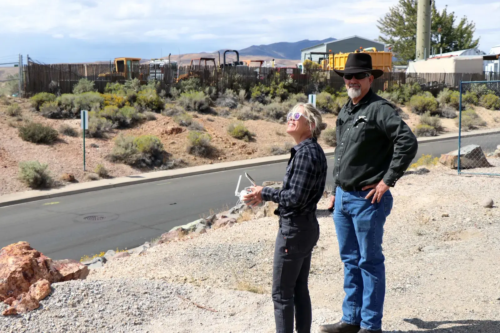
Eastern Sierra Engineering field team operating a UAV controller
Precision begins in the field.ESE / SURVEY + GEOMATICS
Since 1996

Eastern Sierra Engineering

40+ years

Jon Loder’s survey experience

Nevada + California

Regional surveying services

For your property transaction

What does an ALTA survey give you?

An ALTA/NSPS land title survey brings boundary research, title documents, and field observations into a survey plat or map for your transaction team. The scope includes the applicable standards and the optional Table A items you agree with the surveyor.

Scope, cost & timing questions
01On the ground in Fernley

Fernley land and flood-map context.

For a vacant site or a property assembled from several parcels, the first task is knowing exactly what you're working with. The address alone may not describe the full project area.

Highway 95A Ditch area, Fernley

A Highway 95A flood-map revision took effect in 2026.

FEMA's Fernley revision became effective April 13, 2026 and addresses Highway 95A Ditch, its split and shallow flooding near Desert Shadows Lane. Check whether your parcel falls within the revised area. This is a specific map change, not a citywide flood-zone determination.

FEMA revision effective April 13, 2026

Fernley notice and FEMA determination (opens in a new tab)

City of Fernley GIS coverage

City GIS includes infrastructure context.

Fernley's GIS resources include parcel, land-use, zoning and infrastructure mapping. Use them to orient an assembled property or planned improvement, then supply every relevant APN and legal description. Infrastructure layers don't replace recorded easements, field utility investigation or a boundary survey.

Agency resources checked October 1, 2026

City of Fernley GIS (opens in a new tab)

Sources reviewed October 1, 2026. Confirm current records for your parcel when planning the survey.

02Your next step

Fernley / Let’s get to work

Let’s scope
your survey.

Start with the property address or parcel number. Scott Mann will connect you with the ESE surveying team to discuss your requirements and a project-specific quote.

Don’t have the title documents yet? Send what you have. We’ll help identify what’s needed.

smann@civilsolutions.net(775) 828-7220
Eastern Sierra Engineering
Nevada + California
Request a survey quoteESE / Fernley

Start with your contact details and property location. We’ll follow up about scope, fee, and availability.

An address, parcel number (APN), or general site location is enough to get started.

Your inquiry goes to Scott Mann at ESE. Please don’t include sensitive financial information. How we use your information.

03Experience you can explore

The work behind
the experience.

Utility connections and reliable field information matter when planning a property project. These examples pair regional work in Sparks with a commercial ALTA survey led by Jon Loder.

Sparks, Nevada

4th Street Sanitary & Storm Sewer Improvements

Eastern Sierra Engineering

ESE provided civil design and construction management for rehabilitation and expansion of Sparks' sanitary sewer and storm drain networks. The scope included existing-condition assessment, pipe and structure design, bid assistance, submittal review, utility coordination, and materials testing and inspection.

Eastern Sierra Engineering project profile (opens in a new tab)

Location unpublished

Commercial ALTA survey + digital twin

Survey team led by Jon Loder, PLS

Jon Loder led the commercial ALTA survey and digital-twin workflow featured by Engineering the Earth. The team combined UAV mapping with boundary work, ground control, quality checks, and utility ties, then updated the mapping after part of the site was regraded.

Engineering the Earth survey case study (opens in a new tab)

ESE serves the West; Civil Solutions serves the Midwest. Engineering the Earth is our shared online home. You’ll work with the ESE survey team for your Nevada or California property. Meet the wider team

04Surveying + geomatics

The right survey.
A clearer next step.

From the first title review to the last stake in the ground, we help your team understand the site and move the project forward.

01

ALTA/NSPS land title surveys

Bring the property, title records, and field conditions into one clear survey for your transaction team.

We scope the survey around the current ALTA/NSPS standards, the property interest being surveyed, and the Table A items agreed with your lender and title team.
02

Boundary & monument surveys

Understand where the parcel begins, where it ends, and how the evidence fits together.

Boundary research, monument recovery, and field measurements support a documented picture of the property rather than an assumption based on a fence or online map.
03

Topographic & asset mapping

Give your design team a measured starting point for the ground and its existing features.

Define the contours, structures, surface improvements, and asset information your project needs, with AutoCAD, GIS, or PDF deliverables agreed during scoping.
04

Construction staking & layout

Carry the design into the field with coordinated survey control and layout.

Discuss the plans, control, construction sequence, and staking requirements before mobilization so the field work supports the actual stage of your project.
05

Easements & Tahoe land coverage

See how recorded rights and measured site features relate to the property.

ESE provides easement surveying and TRPA land coverage verification services. These scopes are discussed separately from title-survey requirements and agency review.
06

UAV mapping & geomatics

Capture a broader view of the site to support mapping and terrain documentation.

UAV mapping can support site and terrain documentation. The team selects methods around the accuracy, access, and deliverable requirements of the scope.
Meet the full surveying program
05From scope to survey

Start with the details.
We’ll take it from there.

Your property, transaction, and next steps shape the work. We start by defining what your team needs from the survey.

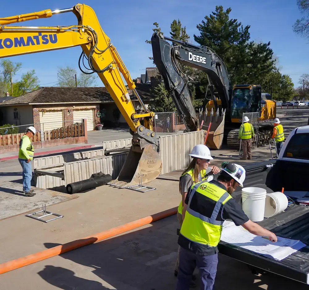
ESE team members reviewing plans together on a construction site
Research. Fieldwork. A coordinated team.
  1. 01

    Tell us about the property

    Share the address or APN, transaction purpose, available documents, and target date. We’ll discuss the scope with you.

  2. 02

    Coordinate the requirements

    We review title information and coordinate selected Table A items with your transaction team. Topographic, utility, or coverage work can be scoped alongside the title survey.

  3. 03

    Build a useful deliverable

    Research and field measurements come together in a survey your team can use. AutoCAD, GIS, and PDF deliverables are available as the project requires.

Have these handy?

Send what you have. We’ll help identify what’s still needed.

  • Property address or parcel number
  • Current title commitment and exceptions
  • Selected Table A requirements
  • Your target date and project contacts
06The people behind the precision
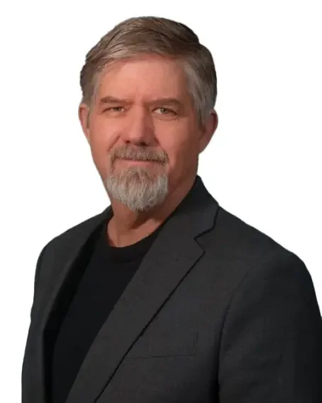
Jon Loder, PLS, ESE Survey ManagerJON LODER / PLS

Survey leadership

Experience in the field.
Perspective for your project.

Jon Loder, PLS Survey Manager

Jon leads ESE's surveying program, bringing more than 40 years of experience to boundary research, field measurement, and the survey information your project team needs.

CaliforniaPLS 7827
NevadaPLS 10842
UASFAA Part 107
More about the ESE survey team
07Good questions

Before we
get started.

Understanding the scope helps everyone start on the same page.

How much does an ALTA survey in Fernley cost?

The fee depends on the property and the agreed scope: parcel count and size, the title records, site access, field conditions, and selected Table A items. Send the address or parcel number and the requirements you have so we can discuss a project-specific quote.

How long does an ALTA survey take?

We confirm the schedule after reviewing the scope, available title information, field access, and current workload. Share your closing or design deadline when you inquire. Record research, weather, and coordination with your title or lender team can affect timing.

How do I request a survey for vacant land in Fernley?

Send the parcel numbers, a location map, and any legal descriptions or title records you have. Tell us whether the next step is a purchase, financing, design, or a proposed land division.

Can the survey cover several adjoining parcels?

Yes, a scope can be discussed for multiple parcels. We'll need to confirm which parcels and property interests belong in the survey and what each member of the transaction team requires.

Will the survey establish whether my proposed use is allowed?

A survey documents the land within its agreed scope. Land-use permissions are a separate planning question, so your project team should confirm the proposed use with the appropriate jurisdiction.

Which ALTA/NSPS survey standards apply?

The 2026 ALTA/NSPS Minimum Standard Detail Requirements took effect on February 23, 2026, replacing the 2021 edition. We'll discuss the current requirements and the optional Table A items your transaction team requests when defining your scope.

Read the 2026 ALTA/NSPS survey standards (opens in a new tab) from ALTA.
Have a property in mind?

Request a survey quote